FFP6-From real topography to digital elevation models (DEM): needs and expectations for flash floods analysis
« Back to list of video collections
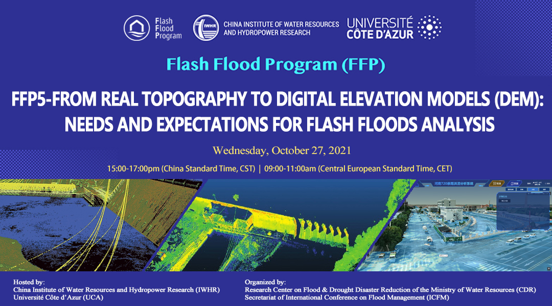
Due to the climate change impacts, the extreme rainfall events become more and more frequent, which often cause big challenges in flash flood prevention and control and important influences on social and economic development. The flash flood forecasting and warming system is the main components in the integrated system of flash flood prevention and control. Obviously, more accurate model simulation will promote the local flood defense capacity. The Digital Elevation Model (DEM) is the core component for the flash floods analysis and the development of modeling solutions. The technology in this sector is developing quickly with new sensors and acquisition modes using UAV and satellite as well. Representation of topography is a major driver for the quality of the models and the accuracy of the results.
In order to clarify both the advantages and limits of different technologies, the Flash Flood Program (FFP) holds this seminar on 27th of October, aiming to provide an integrated overview on the advanced technologies adopted to collect high resolution topographic data under various conditions. The seminar will explore the key aspects of DEM from data acquisition to application with advanced modelling approaches.
Go to the live page of this online event to watch the playback.
-
Ludovic Andres - Overview of HR DEM acquisition techniques
2021-12-01 -
Dongeon Kim - Innovative AI approach in Satellite DEM improvement for flood modeling
2021-12-01 -
Chloe Zhao - High-precision point cloud acquisition and processing in geography
2021-12-01 -
Yizhu Lu - High-precision terrain data acquisition and its application in flood disaster monitoring
2021-12-01